
This page discusses the following topics:
What is a Stockpile Survey?
How do Stockpile Surveys Work?
How much do Stockpile Surveys Cost?
What will you receive from us?
Why would i need a Stockpile Survey?
How we can help with Stockpile Surveys.
Stockpile Surveys
What is a Stockpile Survey?
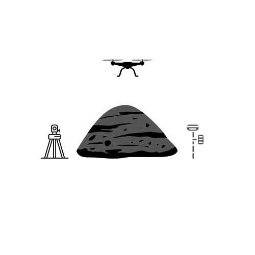
A stockpile survey is an essential service for accurately measuring the volume of stockpiled materials such as soil, aggregates, coal, and other bulk resources. These surveys are critical for industries like construction, mining, and waste management, where precise inventory control is crucial. At Brookes Geospatial, serving clients throughout Lancashire and West Yorkshire, we utilize advanced technologies, including drones, GNSS (Global Navigation Satellite System), and total stations, to provide dependable and accurate volume assessments tailored to your needs.
How Do Stockpile Surveys Work?
Our approach to stockpile surveys in Lancashire and West Yorkshire is customized to ensure the most accurate results:
Site Assessment:
We start by visiting your site in Lancashire or West Yorkshire to assess the stockpiles and choose the most appropriate measurement method.
Surveying Methods:
Drones: Best for large sites with multiple stockpiles. Our drones capture high-resolution aerial data quickly, covering extensive areas across Lancashire and West Yorkshire.
GNSS/GPS: Ideal for smaller, individual stockpiles. This method involves using precise GPS receivers to collect detailed data on the stockpile’s surface.
Total Stations: Perfect for indoor or confined spaces where drones and GNSS are impractical. Total stations provide high-accuracy measurements, capturing exact positions and elevations.
Data Processing:
We process the collected data using specialized software to create a detailed 3D model of the stockpile, allowing us to calculate the exact volume with precision.
How Much Do Stockpile Surveys Cost?
The cost of a stockpile survey in Lancashire or West Yorkshire can vary depending on factors such as the number of stockpiles, their size, and the surveying method used. Prices typically start at £400 + VAT for a single day of surveying. However, larger sites or more complex projects may incur additional costs. We aim to provide competitive pricing while maintaining the highest level of accuracy and service. Contact us for a precise quote tailored to your specific needs.
What Will You Receive from Us?
After completing your stockpile survey, we will provide you with:
Detailed Survey Map: A comprehensive map showing the location and dimensions of each stockpile surveyed on your Lancashire or West Yorkshire site.
Volume Report: A specific volume report for each stockpile, detailing the material type, individual volumes, and total volume on-site. This report is invaluable for inventory management, financial assessments, and project planning.
Why Would I Need a Stockpile Survey?
Stockpile surveys are crucial for businesses in Lancashire and West Yorkshire that need accurate material inventories. Here’s why you might need one:
Inventory Management: If you’re unsure about the quantity of material on your Lancashire or West Yorkshire site, a stockpile survey will provide an accurate measure.
Financial Reporting: Accurate volume measurements are often required for financial assessments, budgeting, and auditing.
Project Planning: Knowing the exact amount of material available helps in planning for future projects or operations.
Compliance and Regulation: Maintaining accurate records of material volumes is a regulatory requirement in many industries.
How We Can Help
At Brookes Geospatial, we pride ourselves on offering tailored solutions to meet the specific needs of our clients across Lancashire and West Yorkshire. Whether you have a single stockpile or a complex site with multiple stockpiles, our experienced team can provide:
Expert Consultation: We help you determine the best method for surveying your stockpiles, ensuring efficiency and accuracy.
Rapid Deployment: Our team can quickly mobilize to your site, minimizing downtime and disruptions to your operations.
Detailed Reporting: We provide comprehensive reports that are easy to understand, giving you the information you need to make informed decisions.
Ongoing Support: We’re here to assist you beyond the initial survey, offering follow-up surveys and additional services as your needs evolve.
If you have stockpiles of material on your site in Lancashire or West Yorkshire and need an accurate measurement, Brookes Geospatial is here to help. Our expert team will guide you through the process, ensuring you receive the precise information you need to manage your resources effectively.
Reach out to us at admin@brookesgeospatial.com to learn more or to request a consultation. We’re here to help you elevate your project to new heights of precision and efficiency.